
It’s time to catch up with the blog!
I’ve got a rain day today (May 17) in Dillon, MT. So I’m catching up on the blog. I’m sticking just to words and pictures to keep it simple. I’ll be updating this to add the missing days before we got to Missoula, MT. But here’s the update for the last few days!
Miles: 911
Ascending feet: 40,791
Peak elevation: 7,422
Current Elevation: 5,323
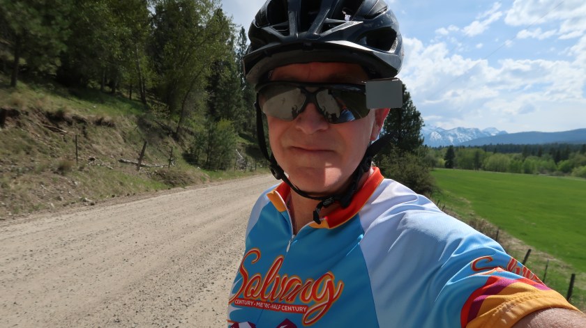
Adventure Ride Day 12 – Wisdom, MT to Dillon, MT
The weather forecast for the next several days is for scattered rain. It looks like today would be clear until the afternoon, so I wanted to get as many miles in as I could before the showers began. Stephanie also had a conference call and needed to get to Dillon early so she could find cell phone coverage. I packed up my rain gear and headed out into a foggy morning. The road was thankfully pretty quiet, and there was enough visibility for the occasional truck to see my flashing lights and yellow rain jacket, so they gave me plenty of room as they passed into the fog.
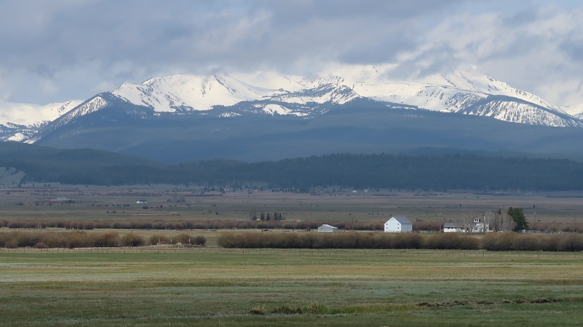
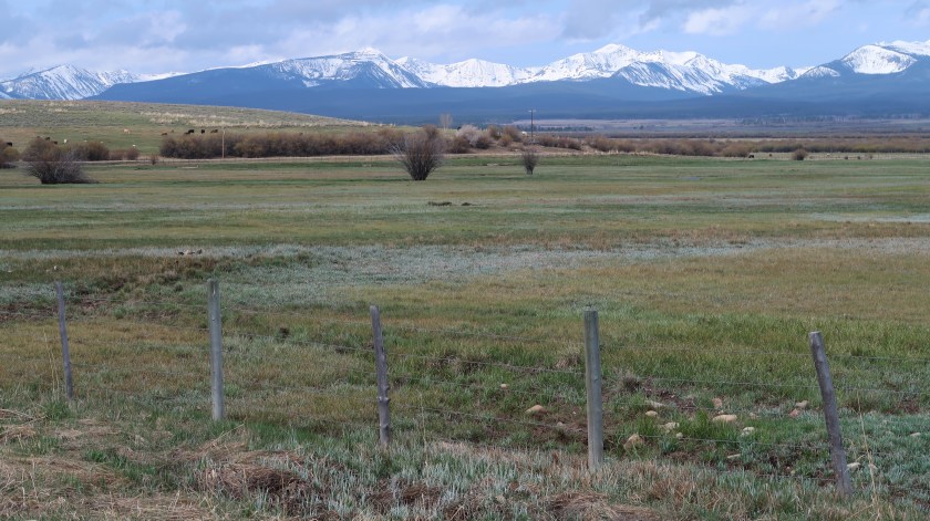
The road was generally flat through the Big Hole Valley. I could see through to the base of the surrounding hills, across boggy pastures providing cattle with abundant fresh grass. Occasionally there would be rolls of hay put up by the farmers. I passed this sign telling me that the area is famous for its hay.

No mention of the history of the Nez Perce people (see Day 11).
I rolled into a crossroads called Jackson, where I saw signs for cyclist camping and food. I was cold and needed a warm cup of coffee, so I stopped at the Jackson Hot Springs Lodge. There really is a hot spring here (Lewis and Clark were introduced to it by the locals), and the owner suggested I take a dip, but I needed to move on to beat the rain. Had a nice chat with Geraldine, who worked behind the bar. She’d grown up in Wisdom, was taking care of her ailing 93 year old mother, and was working this job so she could qualify for Social Security. She’d worked a good bit for the Park Service, building trails and renovating cabins, and couldn’t understand why anyone would want to live anywhere else. Why, the people in Chicago live on top of each other, and there’s so much violence there.

It is true that the people in Montana are genuinely friendly and welcoming. The folks in the lodge told me I was the third cross-country bicyclist coming through this year. It’s a natural stop for anyone following the Transamerica route. Hence, the signs for cyclist camping and food.
After warming up, I headed on down the road. There would be no town or business for the next 50 miles until Dillon. The fog was lifting, and the views of the hills and valleys were amazing.
The second half of the ride was characterized by very strong headwinds and crosswinds. With a tailwind on a gentle grade like this, I’d be zooming along around 18-20 mph. Today, I struggled to keep my speed above 9. With the crosswinds, I’d be leaning left to keep from being blown off the road. But the vista was amazing:

The rain clouds had been threatening all day, and in the early afternoon one of the showers found me. I’d brought my rain gear, so I tried out my Showers Pass rain pants for the first time. On the plus side, they kept me warm and dry. On the negative side, they were too loose-fitting and bulky on the bike, and the fabric didn’t breathe. This is fine for bike commuting but not so great when you have to pedal in them for hours at a time. When the opportunity arises, I’m going to be looking for something slimmer and made from Gore-tex.
Over a couple of passes, fighting the wind, and I rolled into Dillon, where we would stay the night at a KOA campground. That means laundry, good showers, and Wi-fi. We went into the main street area, where we were lured into the Beaverhead Brewing Company pub. Excellent amber ale, no food, but we happened to arrive for “Trivia Night with Dale”.
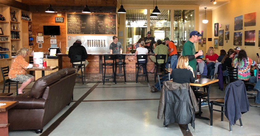
Dale must be some kind of local personality, and he joked as he drew trivia questions from a bucket for the crowd to answer in teams. We scored poorly on the first couple of rounds, and had to leave to find some food.
Miles: 66.4
Avg. speed: 10.8
Ascending feet: 3,045
Peak elevation: 7,422
Ending Elevation: 5,323
Net elevation gain: -708
Adventure Ride Day 11 – Sula, MT to Wisdom, MT
We stayed last night at “Sula Camp”, which is a gas station and a little restaurant with campsites in the back. It advertises breakfast and lunch, and “coffee all day”. So this morning we walked in looking for breakfast. Well the restaurant’s being remodeled, and the water line to the coffee pot is now about 6 inches too short, so there’s no coffee either. The woman who runs the place was so nice, though. She gave us a free cookie (sell-by date unknown),
An hour later, after Stephanie and I had eaten breakfast in the camper, I was off for a relatively short ride, but with a significant climb to Chief Joseph Pass (elev. 7,264 ft). I hoped to get to Wisdom, about 39 miles away early in the afternoon to beat forecasted afternoon thunderstorms. As I made it up the mountain rain began pelting me, and the temperature dropped quickly. I had started in shorts, but as I got to the crest of the pass, I pulled arm and leg warmers out of my bag and suited up for a cold and wet ride the rest of the way. At least it was a short ride.


Water from melting snow coursed through streambeds and bogs along the road, though now I was following its downhill path. It turns out that Chief Joseph Pass sits on the Continental Divide, so this water will flow east, away from the Pacific.

Just before Wisdom, I came upon the entrance to Big Hole National Battlefield. 
Knowing nothing about this place, I stopped at the visitor center, run by the National Park Service, to find out what battle had occurred there. It turned out to be a sad story of a contingent from the Nez Perce tribe, working their way into Montana after having lost the land promised to them by treaty with the US government. You see, someone discovered gold in that land and white settlers poured in, and the government decided to reduce the size of the Nez Perce reservation by 90%. The band of about 800 Nez Perce were set upon by US military and volunteer soldiers. Some escaped and continued to make their way toward safe haven in Canada, but they were again stopped by government forces near the border. Chief Joseph decided that enough was enough and there would be no more bloodshed. Still, a few managed to make it to Canada.


Our campsite for the night is a Veterans Memorial Park in Wisdom. It has no services, and we are the only occupants tonight. From here, we have a vista of cattle grazing land, surrounded by snowy mountain peaks.


Miles: 37.3
Avg. speed: 10.7 mph
Ascending feet: 3,031
Peak elevation: 7,264
Ending Elevation: 6,031
Net elevation gain: 1,641
Adventure Ride Day 10 – Missoula, MT to Sula, MT
We had two rest days in Missoula, which is home to the University of Montana. It was a relief to get out of the bike saddle for a couple of days, and to have time to play with Stephanie in this lovely city.


Missoula is also home to the Adventure Cycling Association, which provides maps and other resources to cyclists interested in cross-country or long-distance rides. It started in 1974 to create the Bikecentennial, a cross-country route to celebrate the US Bicentennial. It has now developed several routes criss-crossing the country. I took their Lewis and Clark route to get to Missoula, and will be using portions of 3 other routes they have developed, including the original Transamerica trail, to get to Yosemite, to travel through the north lakes of Wisconsin, and to travel from Chicago to DC. Having a day off meant Stephanie could join me on a bike ride around the city!

The ride to Sula was supposed to be 90 miles of gently sloping terrain, the first 40 along a long bicycle trail along Route 93, back through Lolo and points south. It turned out to have beautiful views of the surrounding peaks.


I made good time and Stephanie and I met for lunch in Hamilton. It’s a very small town, but we found a nice lunch place on Yelp called the Cherry Street Café. It’s a teeny place stuck in a building populated by hair stylists, manicurists, and massage therapists. The café is run by a nice woman named Lorraine, who does all the cooking herself. The coffee is roasted by another woman in the adjoining space. It was a lovely lunch, and fun to talk about my ride, how she ended up in Hamilton, and how she decided to start her café.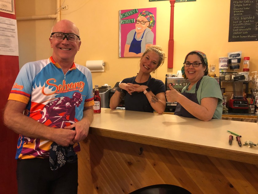
From Hamilton I expected an uneventful continuation south on Route 93, but my pre-planned route was a little different. For some reason, I had plotted a route that took me off the busy highway onto side roads. This time I ended up on a dirt road. I thought “oh this will be paved again soon”, but it took over 10 miles of dirt and gravel to get back to the highway. I was glad to have my gravel bike with 40cm tires on that road. Once back on 93, I decided to stay there and not take side roads the rest of the way.
I continued to make really good time, and was looking forward to getting to Sula earlier than planned, when I heard a whishing sound from my rear tire. My first flat. No problem, I can change a flat. So I pulled over to the roadside, emptied my bag to find my tubes and tire irons and CO2 inflators, and got to work. I couldn’t find anything wrong with the tire, so I expect it was the valve that somehow gave up on me. Perhaps the hard ride over the gravel road had pounded it to submission. I replaced the tube and went to work to get the tire seated back on the rim. This is the hard part of changing a tire, because the last part of the tire requires all kinds of rolling and shaping and thumb pressure to get over the rim. This was the first time I had attempted to change a tire on this bike, and I found it to be almost impossible to get the tire over the rim. I pushed and rolled and pushed some more. I got out my tire irons to try to ease the tire over the rim that way, without success. I worked on it for about a half hour, and considered calling Stephanie to come pick me up. But I was determined to succeed with this, and finally after about an hour of work I was able to ease the tire over the rim. 
I had lost a lot of time. But I was back on the road and pushed hard to get to Sula by nightfall.
Miles: 83.2
Avg. speed: 12.2 mph
Ascending feet: 2,313
Peak elevation: 4,468
Ending Elevation: 4,468
Net elevation gain: 1,313
